First of all, I would like to wish all of my readers a very Happy New Year! I have certainly been busy for the first few days of January, as you will find out below. This is quite a long post, so grab a cup of your favourite hot drink and read on!
The second day of January spelled the first bright day of 2025, and with the kids still being off school, it seemed the perfect time to start the walk along the course of Hadrian’s Wall from South Shields to Bowness-on-Solway (a total of 91 miles), a.k.a. ‘Walking the Wall for Daina’ (WTWFD). Bright it was, but warm it was not, so my youngest son and I wrapped up before taking the Metro to North Shields, where we would catch the ferry that would transport us to the starting point of our walk. But, before I go on, something in the way of introduction.
About Hadrian’s Wall
Work on Hadrian’s Wall began in 122 A.D., its purpose being to mark the Northernmost frontier of the Roman Empire, and keep the local (Pictish) tribes from conducting raids in Roman territory. The length of the wall, from Wallsend to Bowness-on-Solway, was 80 Roman miles = 73 modern miles. It took several years to construct, and was manned until the Romans left Britannia in the fifth century A.D. Over time, much of the Wall was dismantled and used to build local churches, farms and houses, but sections of the wall still remain and have been consolidated and reconstructed. As such, the wall has entered the folk-memory of those who live within its compass.
About the Hadrian’s Wall National Trail
A path following the line of the Wall from Segedunum (Wallsend) in the east to Bowness-on-Solway in the west was established in 2003. Many people from all over the world walk the Wall every year, or visit sections of it, in order to marvel at this ancient wonder, which has been designated a UNESCO World Heritage Site. Along the trail, we will encounter many Roman forts, turrets and milecastles, as well as other, more subtle traces of this once-vast empire.
About the challenge
As many readers will already be aware, I lost my aunt Daina to Motor Neurone Disease in April of last year. Daina was a fighter, and refused to let the disease beat her down. Every time I went to visit her, she would manage a smile, and enjoy talking to me through her computer, using eye-gaze technology. It was through this technology that she also succeeded in writing a book, My Life with MND, which was published by EIF in 2022. An all-time bestseller, this book has raised funds to help others living with the disease, as well as giving an insight into what life is truly like with this debilitating condition. Daina was recognised for her efforts with a BBC Make A Difference Award in 2023. I am walking the Wall for Daina in order to raise funds for the North and West Cumbria branch of the MND Association UK, who provided practical support and advice to both Daina and her friends and family throughout her life with MND.
Journal, 2nd January 2024
The first day’s walking would not, in fact, be a Wall walk, but a walk along what had once been the Roman frontier, which began at the fort of Arbeia in what is now South Shields. The Hadrian’s Wall Trail proper begins at Wallsend, but I wanted to make this a full-scale coast-to-coast challenge.
Crossing the Tyne by the Shields ferry is always invigorating, and usually quite chilly. Today was no exception. Rather than hug the shelter of the interior cabin, however, my youngest and I sat up on deck, at the prow of the ship, in a bracing westerly wind. Mercifully, the crossing only took five minutes, and the views were splendid.

Upon arriving in South Shields, it was first necessary reach the starting point of the walk: the North Sea, where we would dip our boots ceremonially to mark the beginning of the adventure, after posing for obligatory photos in the eye sculpture, emblazoned with the lyrics to ‘Blow the wind southerly.’
Boots duly christened, and feet unavoidably soaked, we set off up the steep bank of steps leading through North Marine Park to Arbeia Roman Fort.
About Arbeia

Arbeia means ‘place of the Arabs,’ and the fort was given this name in reference to the bargemen of the Tigris who were employed here to navigate the shallow waters at the entrance to the River Tyne. Thus, goods from throughout the Roman Empire could be shipped into Britannia, hence Arbeia’s importance to both the Empire, and our route west. The museum is free to visit and contains extensive Roman remains as well as reconstructed buildings, which tend to divide opinion: purists prefer these sites to be left as found, whereas others appreciate the more concrete visualisations. As the museum is closed for winter, however, we had to postpone our visit until a later date.
Arbeia would be our last glimpse of anything remotely Roman-looking for today. From the fort, we headed down towards the docks where modern housing developments dominate. We spotted the ferry coming in, so were lucky enough to secure a fast recrossing of the Tyne by picking up our pace a little.
Shunning the warmth of the cabin once again, we ate lunch on deck, then alighted to follow the Hadrian’s cycleway (Route 72) onwards to Wallsend. The route took us through some rather desolate looking industrial landscapes, roughly following the course of the River Tyne westward. Some of the more interesting scenery we passed through included the Royal Quays — a glittering Marina from which the DFDS ferry departs for Amsterdam every other evening; Chirton Dene (where the ducks struggled to swim in pools of algal scum); Redburn Dene park with the skeletal remains of Wet ‘n’ Wild water park as a backdrop; and the impressive iron railway bridge which carried the Metro tracks into Hadrian Road station. This latter was a welcome sight, as it seemed that after long hours of skirting busy roads and urban undergrowth, we were getting close to Wallsend. The viewing tower of the Segedunum visitor centre at South Shields (where the Wall begins) soon came into view. It was closed for the winter, but this didn’t matter, as we were cold and tired, and happy to have completed Stage 1 of the walk. Congratulations are in order to my youngest, who complained not at all of the cold miles walked through icy winter winds. We were rewarded with a front seat on the Metro back to our starting point.


Stage 1: South Shields to Wallsend (Segedunum)
Distance: 7.38 miles
Elevation gain: 352 ft
Time: 2 hours, 40 minutes
Journal, 3rd January 2024
With legs and feet still aching from the previous day’s efforts (when we had walked more like 9 miles with all the transfer time which did not form part of the trail), we boarded the Metro to return to Wallsend and continue our walk. I was once again accompanied by my youngest, who is a keen walker, and certainly did not want to take today as a day of rest! We’re trying to use public transport as much as possible on the walk, which meant a long wait on a cold platform, but the trusty Metro train shuffled into our station in time to get us to Wallsend for 11 a.m. We took a quick detour to stock up on picnic food, then set off from the fort of Segedunum, the true start of Hadrian’s Wall, and the National Trail.
About Segedunum

Hadrian’s Wall originally began upriver, at the bridge named Pons Aelius, but it soon became apparent that the Wall would have to be extended to this point to prevent incursions by Celts, who could enter the territory by crossing the Tyne at Ouseburn. So Segedunum fort with its bathhouse and adjoining civilian settlement (vicus) was built. The fort was originally garrisoned by the same Tigris boatmen who gave Arbeia its name, and ensured wares from throughout the Empire were transported safely into the province of Britannia. Just outside the museum enclosure, you can find the first section of consolidated Wall along the trail.
The trail from this point was well signposted, and led us along the edge of an urban landscape tarnished by littering, deprivation and a general disregard for the natural and historical environment. We visited the remains of a Roman bath house belonging to the fort, before continuing on our way past scrapyards, burnt-out cars and boarded-up windows. At times, the route felt vaguely threatening, and I was glad to emerge onto the riverside, where we found coarse fishermen who wished us well on the walk, alongside boy racers drifting their tyres around the car park, and young boys on bikes, seemingly looking for trouble. This is what the Cicerone Guide (wonderful though it is) doesn’t tell you!
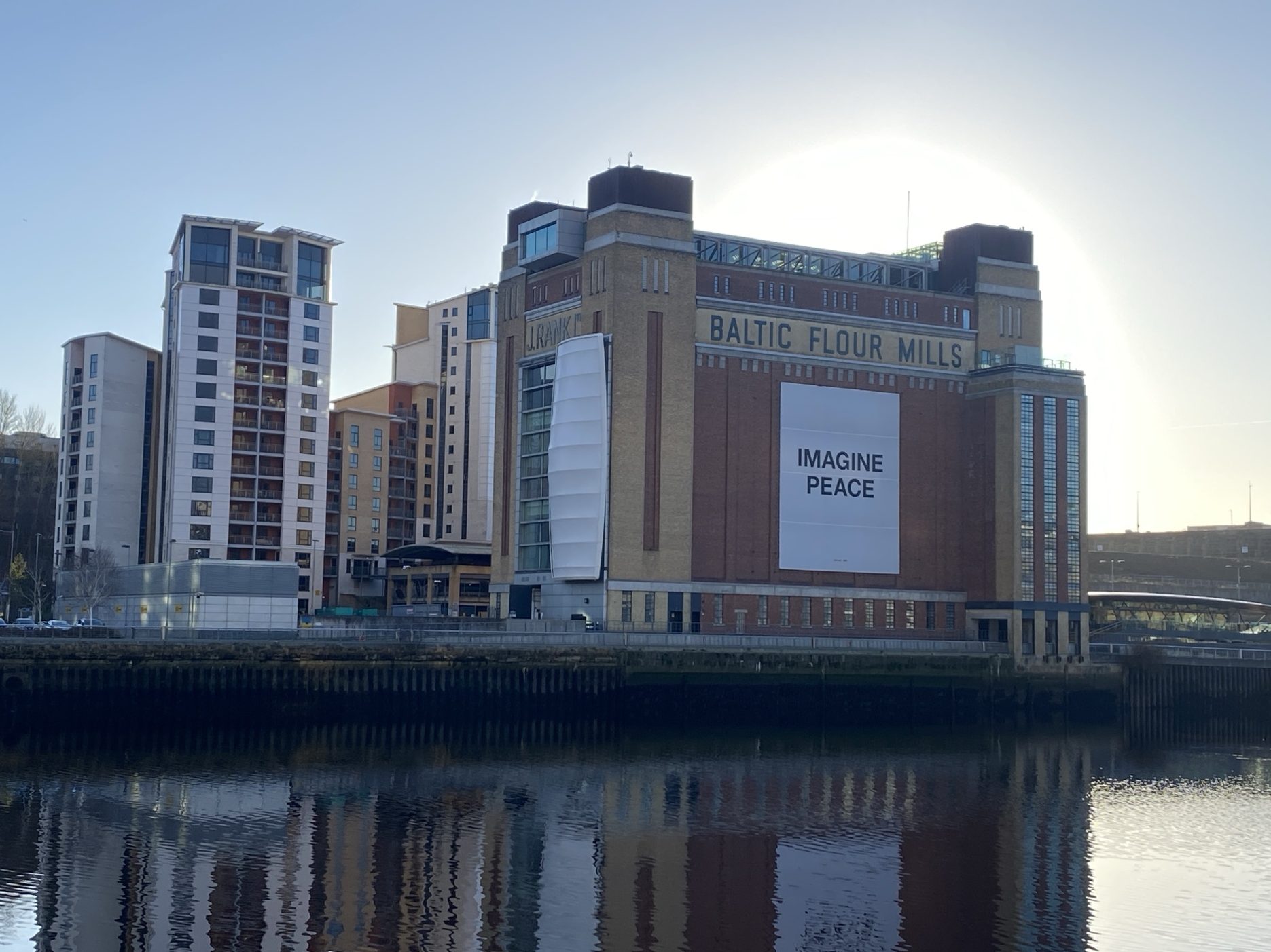
I was relieved when we made it to the riverside housing development known as The Ropery, leading to St Peter’s Marina with its small dock and curious swing bridge, opened by Princess Diana in 1991. Here we stopped at the pub for a soft drink, crisps, and our picnic lunch. We found two shipwrecks on our way: one the skeletal remains of a hull washed up in the tidal mud of the riverbank; the other an apparently abandoned fishing boat floating at the edge of the Marina.
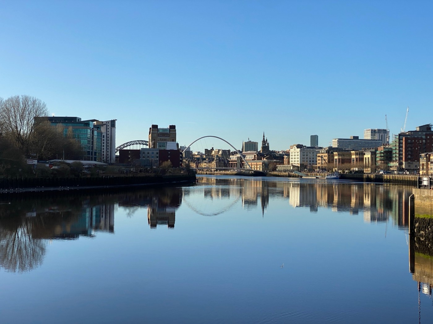
Setting out from St Peter’s Marina, the city of Newcastle glittered like the Emerald City, with the waters under its famous bridges a crystal clear mirror on this bright winter day. I had the strange feeling of being a pilgrim from a distant time, overawed by the wonders of the great city, after having been used to the mud-hut scrubland on its outskirts. Here in this enchanting landscape, this section of the trail drew to a close. But the walk was not quite over: we had to trek up the hill to Central Station to pick up my eldest son, and then further into town to catch the Metro from Monument. I could’ve done without the extra miles, though I thoroughly enjoyed this second stage of our journey!
Stage 2: Wallsend (Segedunum) to Newcastle Quayside
Distance: 5.5 miles
Elevation gain: 123 ft
Time: 2 hours, 17 minutes


A HUGE thank you to all who have donated so far. At the time of writing, we are 4% of the way towards our £1000 target. I’d be truly grateful if you would visit my fundraising page and leave a donation, if you are able. Every penny donated will make a difference to the lives of those suffering from MND. I’ll be taking a break from the trail for a few days now to get the kids ready for school, but do watch out for updates. You can also follow our progress on Instagram @Experimentsinfiction.
Thank you for reading,
Ingrid

So impressive, Ingrid! I had to find a map as I have no idea where any of these places are. 🙂
LikeLike
Welcome to Roman Britannia 😉 thank you for following our progress, Merril!
LikeLike
You’re welcome, Ingrid!
(Just to be clear, I did know Hadrian’s Wall, of course and Newcastle 😂).
Good luck with your journey and this worthy cause!
LikeLike
What an adventure you and your son have embarked on–and for a worthy cause! I look foward to your updates.
LikeLike
Thank you, Liz – I look forward to continuing the trail!
LikeLike
You’re welcome, Ingrid!
LikeLike
Love reading accounts like this now we are not so mobile
David and Pamela Hopcroft
LikeLike
Thank you, David and Pamela, and thank you for your generous donation 🙏
LikeLike
So proud of you and your family’s accomplishments! Fascinating history and beautiful photos. Thank you very much for sharing, Ingrid. The repurposing of the wall is intriguing to consider. Would love to visit someday! ✨
LikeLike
It’s well worth the visit, Michele, thank you!
LikeLike
I believe you! You’d make an excellent tour guide! 😄
LikeLike
Wow! Incredibly interesting and such a noble cause, Ingrid. I admire your youngest son.
Happy new year.
LikeLike
Thank you, Punam, and Happy New Year to you!
LikeLike
You are welcome, Ingrid.n
LikeLike
This is quite an adventure Ingrid. I look forward to the future stages. I like that your son is such a game walker as well. It’s an excellent habit to cultivate. (K)
LikeLike
I agree, Kerfe, thank you: I was not such a keen walker at his age!
LikeLike